
Not everyone has four or five days to give Mount Kenya. Some people are in Nanyuki for work, some are passing through on a safari, and some simply do not want to sleep on the mountain. The Sirimon route is the answer for all of them. It is the only side of Mount Kenya where a vehicle can take you deep into the national park, and that single fact makes a one-day hike possible for almost anyone – from a family with young children to a seasoned hiker who wants a full day in the high moorland.
This guide covers the two ways we run a Sirimon day hike: a short walk from Old Moses to the Meteorological Station for people who cannot or do not want to walk far, and the full day hike to Likii North or the View Point for those who want the serenity of the upper mountain and a view of the peaks.
Why Sirimon for a day hike
Sirimon Gate sits at about 2,650 m on the north-western side of the mountain, 15 km from Nanyuki town. From the gate, a rough road climbs 9 km through montane forest and giant bamboo to Old Moses Camp at 3,300 m. On a multi-day trek this is the first day’s walk – about two hours, longer with photo stops. On a day hike you have a choice: walk it, or let our 4×4 do it for you and spend your energy higher up. No other route on Mount Kenya lets a vehicle reach the moorland, which is why Sirimon is our standard route for one-day hikes.
The park is open from 6.00 am to 6.00 pm. Everything below is planned around being back at the gate before it closes.
Option 1: Drive to Old Moses, walk to the Meteorological Station
This is the option for people who want to experience the mountain – the thin, cold air, the weather, the strange scarce vegetation – without a long hike. It suits families, older visitors, anyone with a knee or back that does not like long descents, and visitors who are short on time.
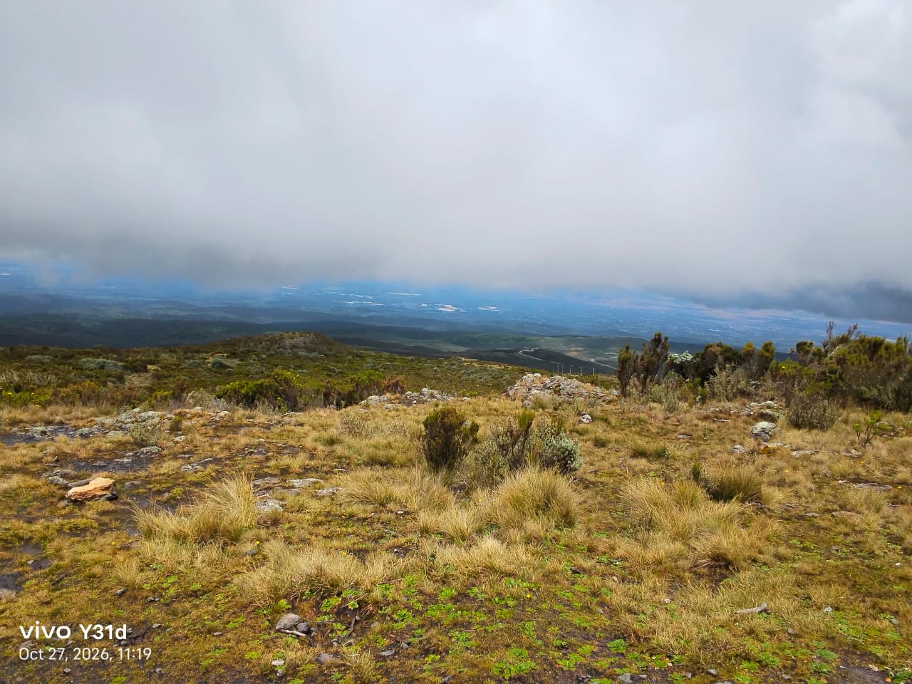
We pick you up in Nanyuki at 8.00 am, clear the park formalities at Sirimon Gate, and drive the 9 km road to Old Moses. The drive itself is the first lesson in how a mountain works. You start in dense montane forest, pass through a band of giant bamboo, then into the heather zone where the trees shrink and thin out. By the time the vehicle stops at Old Moses the forest is gone: you are standing in open moorland of tussock grass, giant heather and the first everlasting flowers, with the Laikipia plains spread out below you.
From Old Moses you walk. The Meteorological Station sits on the ridge directly above the camp – a short, steady climb of about 1 km that most people cover in 30 to 45 minutes at an easy pace. There is no rush; the point of this walk is to slow down and look.
The Meteorological Station
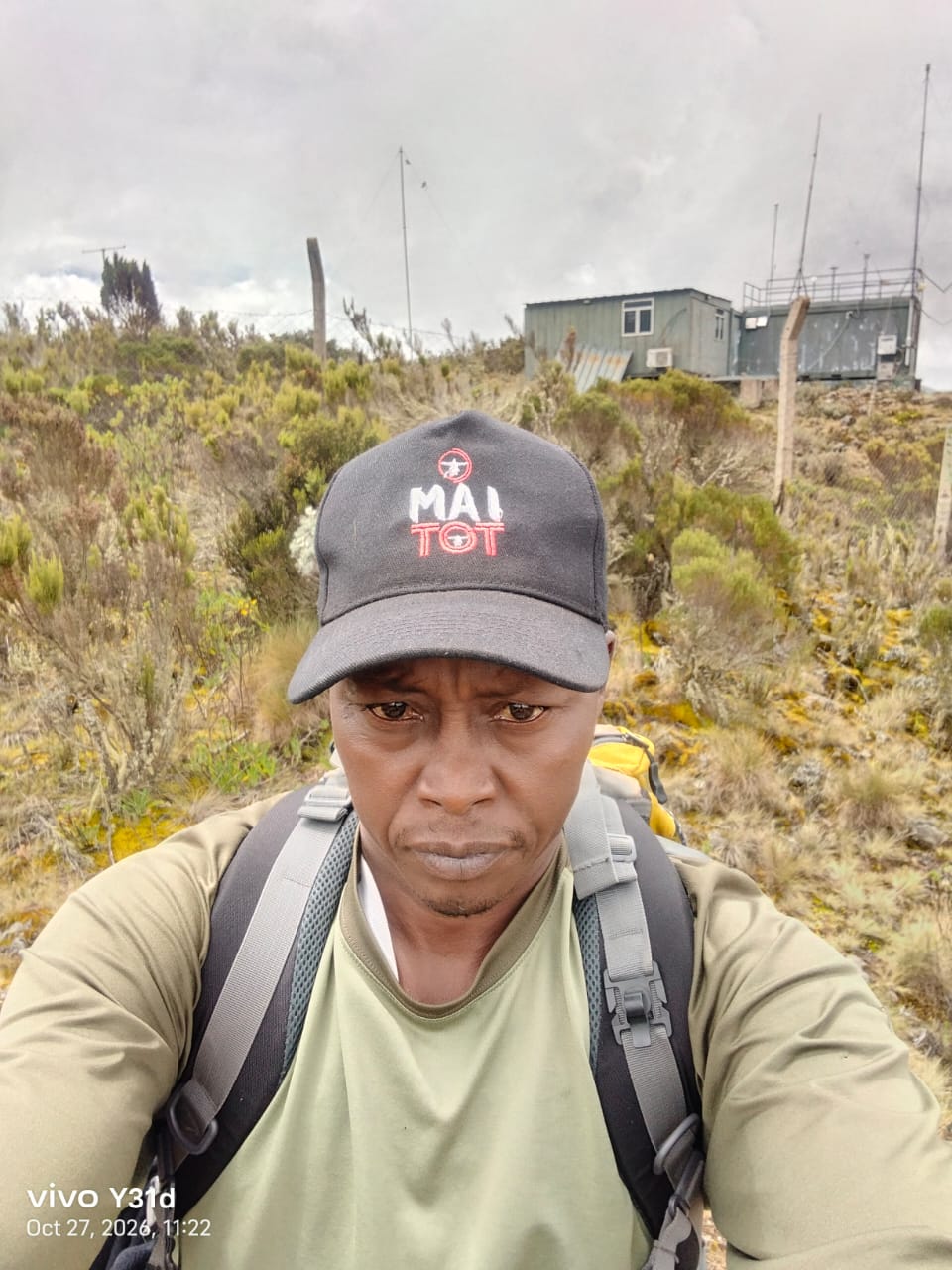
The station is one of the high-altitude weather stations maintained on Mount Kenya by the Kenya Meteorological Department, together with the communications masts that serve the park. It is a small fenced compound of instrument masts and equipment containers sitting at roughly 3,500 m above sea level. The instruments record temperature, wind, rainfall and humidity on the mountain, and this data feeds the weather forecasts for the Mount Kenya region and the long-term records used to track how the mountain’s climate is changing – including the retreat of its glaciers.
For a day hiker it is a perfect turning point. You are above the forest, high enough to feel the altitude in your breathing and the cold on your skin, and the ridge gives a wide view north over Nanyuki, the Laikipia plateau and on a clear day the hills towards Samburu. The vegetation around you is the real reward: a sparse, hardy mix of tussock grass, heather, lichen-covered rocks and the small cushion plants that survive the nightly frost. The photo above was taken at the station on an overcast morning – the clouds were rolling over the ridge within minutes of it being taken, which tells you everything about the weather up here.
You walk back down to Old Moses, where we serve a hot lunch, and the vehicle returns you to the gate and on to Nanyuki by mid-afternoon. Total walking: roughly 2 km, with about 200 m of ascent.
Option 2: The full day hike – Likii North or the View Point
If you are fit and want a proper day on the mountain, the vehicle still takes you to Old Moses, but from there you walk up for the morning and turn around at about 1.00 pm to be back at the gate before 6.00 pm. We offer two routes from Old Moses, and both give you excellent views of the main peaks – Batian, Nelion and Point Lenana – from a distance.
Route A: Likii North
From Old Moses the trail crosses the Ontulili and Likii North rivers and climbs into the Likii North valley, a quiet U-shaped valley on the northern flank of the mountain. The path is well graded and the altitude gain is gradual. The valley is wild and little visited; most trekkers take the direct Mackinder’s valley path to Shipton’s, so on Likii North you will often have the mountain to yourselves. Giant lobelia and giant groundsel start to appear as you climb, and buffalo and eland are common on the lower slopes. Depending on pace and weather, the turning point is the upper valley below Likii North Hut (about 3,990 m), from where the peaks stand up clearly at the head of the mountain.
Route B: Towards Shipton’s to the View Point
This follows the main Sirimon trail up the ridge from Old Moses towards Shipton’s Camp. It climbs steadily through the moorland to a saddle and a rocky promontory we call the View Point, roughly halfway to Shipton’s. From here the whole upper mountain opens up in front of you: Mackinder’s valley running up towards the peaks, Batian and Nelion rising behind, with Point Lenana to their left. It is the classic Sirimon view and the best peak photograph you can get on a day hike. We stop here for a packed lunch and turn back down.
The weather, and why we turn at 1.00 pm
Both routes give excellent peak views – assuming the weather is not cloudy. On Mount Kenya it can change very fast during the day. Mornings are usually clear; by late morning the clouds build on the slopes, and by early afternoon the peaks are often hidden and rain or sleet can arrive with little warning. This is why we start early and why we turn around at about 1.00 pm regardless of how far we have got. Your guide carries a satellite phone, watches the sky, and makes the call. The descent back to Old Moses is quicker than the climb, and the vehicle is waiting for you there.
The full day hike covers 12 to 16 km with 500 to 700 m of ascent, most of it above 3,300 m. You should be a regular walker, but you do not need climbing experience. Good shoes, a warm layer, a rain jacket and a hat are essential; we provide walking sticks, water and snacks.
Serenity
If you want to experience serenity on Mount Kenya, this is the hike to do. There is no summit pressure, no 3.00 am alarm, no altitude headache. You walk for a morning in complete silence through a landscape that looks like nowhere else in Kenya – moorland, giant plants, rock and cloud – with the peaks watching over you, and you are back in Nanyuki for dinner. Many of our multi-day clients tell us afterwards that the quiet morning in the moorland was the part of the trek they remember most. On a day hike, that quiet morning is the whole trip.
What is included
- Pickup and drop-off in Nanyuki (Nairobi pickup can be arranged)
- 4×4 transport from Sirimon Gate to Old Moses and back
- Mount Kenya National Park entry fees
- A professional KWS-licensed mountain guide (two guides for larger groups)
- Walking sticks, drinking water, snacks and lunch
Both options run on any day of the year, for a single hiker or a group. The short walk to the Meteorological Station can be combined with the family forest walk below Old Moses if you have children in the group.
To book a Sirimon day hike or ask about dates, message us on WhatsApp or use the enquiry form. If you decide you want more than a day, our Sirimon route itineraries cover the 4, 5 and 6-day treks to Point Lenana.